UAS (Drone)-based
Thermal and Multispectral
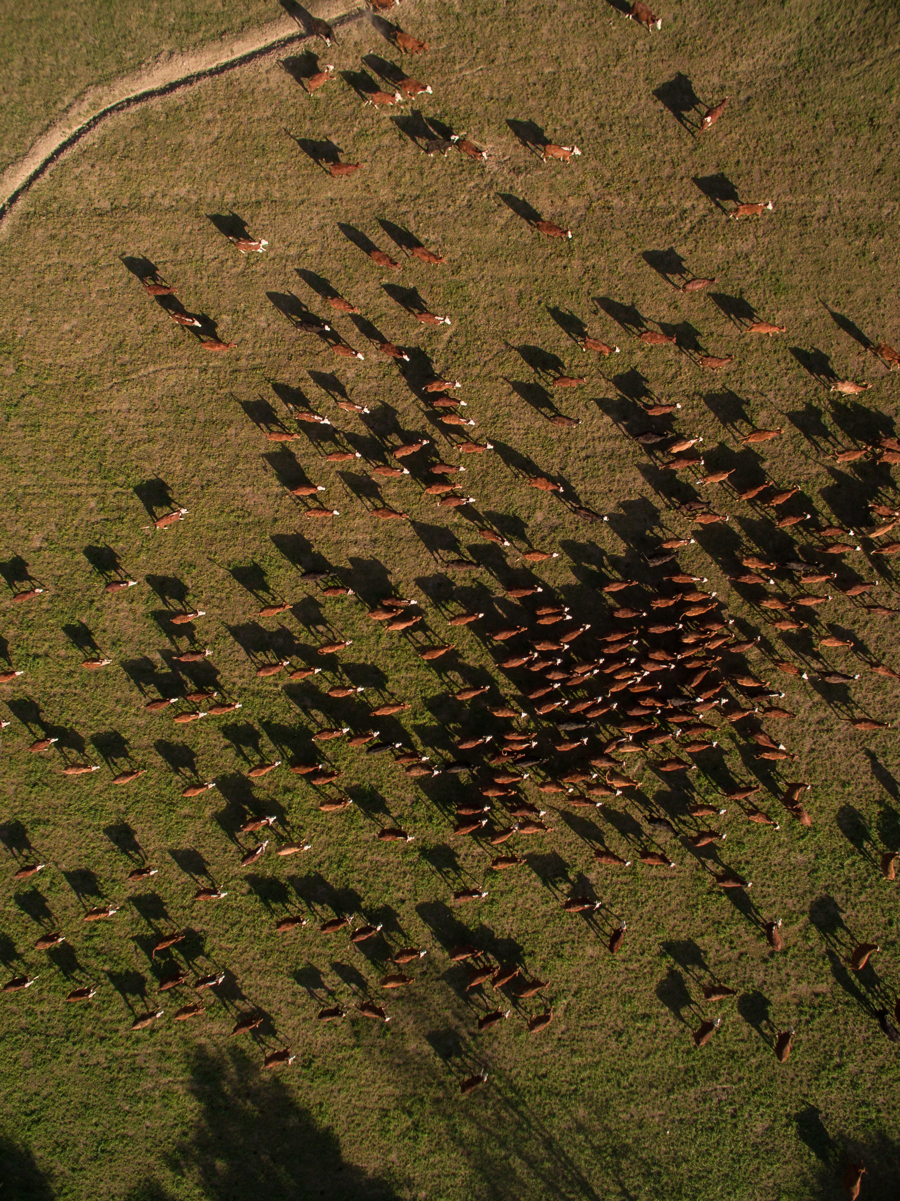
With partners such as the Catalina Island Conservancy and the Institute for Creative Technologies, researchers have conducted a variety of projects leveraging fixed-wing multispectral and thermal imagery from thermal mapping/measurements of structures to evaluate building efficiency to surveys of deer and bison on Catalina Island.
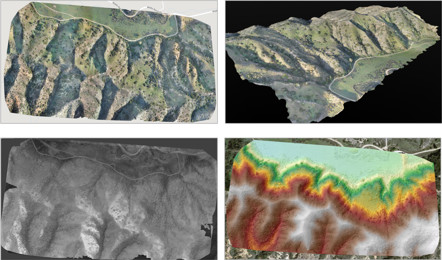
The HSGI Lab works with fixed-wing unmanned aerial systems (UAS) with flight times of more than an hour to create high-resolution orthomosaics (top left), high-resolution terrain models (top right), thermal maps (bottom left) and digital elevation models (bottom right).
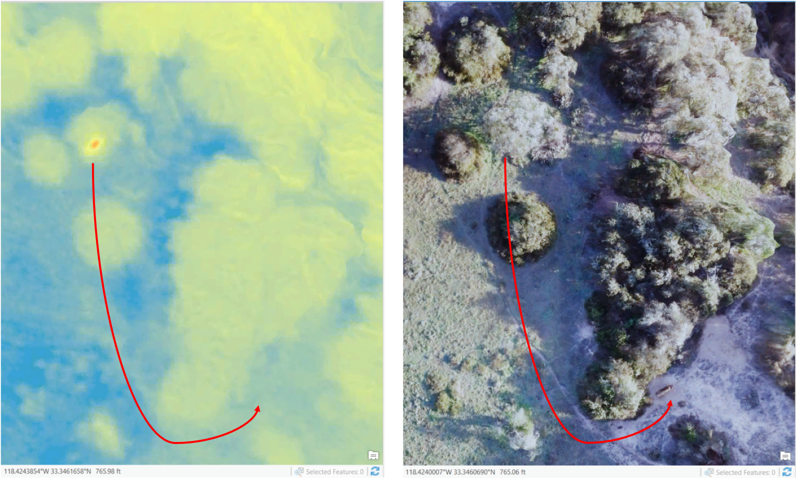
Unmanned aerial systems (UAS) with thermal sensors can detect bison through their heat (red area) when compared with the surrounding landscape (right). In this example the HSGI flew the thermal sensor just at sunrise, and the optical camera an hour later to capture the bison moving a slight distance (right).